IN THE 17TH CENTURY, the Four Corners region turned cruel. Chaco’s Ancestral Puebloan people had fled three centuries earlier, their elaborate social structure abandoned as the culture’s various tribes rooted themselves more deeply in places they still call home. With their sheep herds and corn crops, Diné people crafted an enviable standard of living in the territory left behind.
But the hardscrabble land of canyons and mesas proved capricious. Droughts vied with monsoonal torrents to challenge survival. Unrest among nearby tribes grew dire after the Spanish reconquest in 1692. Conquistadors aligned themselves with Pueblo people, who accused the Diné of raids. Slave trading persisted, and Diné families feared the loss of their children to Ute and Comanche invaders, who could exchange the young ones for horses and guns.
Many families fled into remote canyons within or near what became the Navajo Nation. In Largo Canyon, southeast of Bloomfield, they chose towering outcrops with often treacherous climbs and built rock structures—sets of small and usually square rooms with timber ceilings that could hold one or several families—atop them. From there, they could spy an incursion.
Ron Towner, a University of Arizona archaeologist who has researched the sites, bluntly defines the mood of the times: “You are not safe. Everyone is at risk.”
Within 70 years, the estimated 200 or more defensive sites had been deserted. The Diné moved west and south onto land they occupy today. The abandoned structures, left to erode in the elements, have alternately baffled and intrigued archaeologists, faced threats from oil and gas development, and welcomed mindful visitors to marvel at the former inhabitants’ petroglyphs and dwellings.
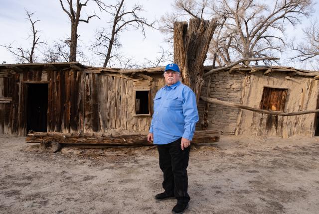
A former home at Aztec Ruins.
Jeremy Wade Shockley.
Today, as Larry Baker brings his high-clearance truck to a stop, the places seem to hum with tales of a troubled time in this lonely and largely uninhabited place.
“Look up there,” he says, handing me a pair of binoculars. An archaeologist and executive director of Bloomfield’s Salmon Ruins Museum, Baker has divined the maze of oilfield roads to introduce me to Largo Canyon’s hidden treasures, one of a range of small group tours the museum offers. I squint at a sandstone ridge whose tips remind me of the mouse-chewed edge of a book. Finally, I spy a more regular array of piled rocks. “That’s it!” Baker exclaims. “They’re always hard to spot and sometimes harder to get to.”
The lives led at Salmon Ruins, Chaco Canyon, and Aztec Ruins hold a long and even fabled fascination in New Mexico. But during the pandemic, this area, which archaeologists call the Dinétah, saw a small but significant uptick in visitation. Overseen mostly by the Bureau of Land Management (BLM), with a few sites protected by the State Land Office, this particular region contains 46 archaeological spots. Together, they serve as an important benchmark for the Navajo Nation.
“The way my dad and uncles explained it to me was that those defensive sites were put up because of prehistoric monsters that were killing people,” says Timothy C. Begay, cultural specialist with the Navajo Nation Heritage and Historic Preservation Department. “After that, they were because of warfare. A lot of times, those places that we left in order to find better places, we go back to them to remind ourselves to live by the natural laws. They’re left in place to make sure we do that.”
A kiva at Salmon Ruins.
AROUND 1915, the first archaeological surveys of the Dinétah uncovered metal axes, gun parts, trade beads, nails, hides, and the remnants of forked-stick hogans. The rock structures reminded early archaeologists of Chacoan villages, and they named them pueblitos, Spanish for “little pueblos.” They theorized that these were either Chacoan outliers or refugee sites for Puebloans following the Spanish reconquest.
But later researchers noted that only one site—Tapacito Ruin, in Largo Canyon—bore the skillful stonework and exacting patterns that Chaco people notably used. In addition, that site sits on a promontory easily visible from nearly any angle. The defensive sites, by contrast, feature a looser construction. Also, most are difficult to access and nearly impossible to see from the roads.
“We have no population estimate and see only about a dozen years for each of the pueblitos’ occupations,” says Baker, who has studied Chacoan and Diné sites for most of his lengthy career.
He drives us past Blanco Canyon and into Largo Wash on dirt roads, built by oil and gas developers, that are reasonably well-maintained—except during and after rainstorms and snowfall. (“Largo Wash swallows entire cars,” Baker says.) The thin bosque holds spindly cottonwoods and a few head of cattle belonging to a handful of nearby ranches.
Baker slows his truck and points to a sheer cliff to our west. Part of Star Canyon, it rises into a set of natural spires that mimic a cathedral. Somewhere up there, invisible to our eyes, is the Star Rock Refuge. “It’s almost inaccessible,” Baker says. “We had to use ladders and ropes to get to it. Whoever built that was very afraid. What could make you that afraid? Somebody trying to steal your children.”
A massive structure in Chaco Canyon.
As we continue, I note pocket caves in the rock crevices and occasional hoodoos, the weirdly eroded rocks that abound farther south in the Bisti/De-Na-Zin Wilderness Area, another destination on the Salmon Ruins Museum tour menu. About 18 miles south of US 64, we turn into the well-marked Crow Canyon. From the parking area, Baker leads me past interpretive panels and toward a buff-colored wall, and then we turn left, where the first Diné petroglyphs appear. They’re a set of inscrutable figures and what could be a thunderbird. But this is just the amuse-bouche.
We thread through Russian thistle and other stickery plants to a more secluded wall that abounds with rock art. A warrior with a large, round shield. Human figures holding hands. A corn plant. Conquistadors on horseback.
“We can’t date them because they’re on sandstone,” Baker says, adding that petroglyphs in other regions are usually on harder basalt rocks that develop a patina with age. “These were probably not all done at the same time. Some are related to religion or to their own personal experience.”
Rooms lead to even more rooms at Chaco Culture National Historical Park.
“We emerged as one people … It was one voice, one people, one belief. We have sacred places that we still visit all over this area.”
—Timothy C. Begay (Diné)
The petroglyphs, along with even more defensive sites, appear all the way up to Frances Mesa, near Navajo Lake. Begay says that some show people as stick figures; others bear people with defined calves and arms. “My elders say that when the two boys [the Monster Slayer Twins] went to see their father, the Sun, they went through trials and tribulations, and finally the Sun accepted them,” he says. “By then they had a sister who remolded them and made them more defined. Those petroglyphs were made after the twins came back.”
Shaft House overlooks Crow Canyon.
The story melds with the tribe’s longer-lived sense of its history in the area, a history centuries older than archaeologists can prove. The scientific research points to Athabaskan people (Diné and N’dé, or Apache) traveling across the Bering Strait and working their way down to the Southwest around the 1400s. The Diné say they were here far earlier, emerging near a lake in southwestern Colorado, and that First Man and First Woman settled at Gobernador Knob, a sacred mountain south of Navajo Lake. Begay says his people have always been here, something that future archaeology may yet confirm.
“We emerged as one people,” he says of all the tribes that occupied the Four Corners. “We were one culture until Chaco fell. It was one voice, one people, one belief. We have sacred places that we still visit all over this area. If we came across the Bering Strait, why don’t we have sacred places in Canada and Asia?”
Light and dark layers of rock reveal classic Chacoan construction at Aztec Ruins.
CHACO CANYON’S DOMINANCE was beginning to teeter when an advance team laid out new structures at today’s Salmon Ruins in 1068, as shown by tree-ring dating. Eventually, the site boasted up to 300 people, 150 ground-floor rooms, and 60 second-floor rooms. “This was a busy place,” Baker says.
He and other researchers have found more than 1.5 million artifacts, ranging from ceramic vessels to animal bones, including nine macaw skeletons that speak to trade with Mexican tribes. The place now known as Aztec Ruins was then rising as the new seat of Chacoan power, and together, the three sites tell a fascinating story of Ancestral Puebloans who crafted architectural wonders, practiced astronomy, held massive ceremonies, and left lingering mysteries over who they were and what roles social unrest, drought, and the depletion of natural resources played in their culture’s collapse.
Even today, says Nathan Hatfield, supervisor of interpretation at Chaco and Aztec, we don’t know the true size of either site, and future excavations are unlikely. “Digging isn’t going to tell us anything we don’t already know,” he says. “Nothing is going to shine a light and confirm or deconfirm all these theories. And as soon as you expose anything to the elements, deterioration begins, so you have to preserve it.”
from left
Rooms at Chaco; A doorway to a room at Aztec Ruins National Monument.
Begay and the Navajo Nation work closely with the BLM and State Land Office to document and monitor their sites, where evidence of raucous parties has been found and petroglyphs have been chiseled off, likely for souvenirs or black-market sales. “Most visitors are respectful,” says Erik Simpson, lead archaeologist for the BLM’s Farmington field office. “I think most people just want to enjoy and appreciate them.”
Beyond the Salmon Ruins tours, the Dinétah attracts visitors who go to the eight sites laid out in a BLM brochure or, unfortunately, explore more fragile sites on their own. A team of volunteer site stewards monitors how well they behave and recently discovered that someone had brought ladders and ropes to get to a defensive site that the BLM would prefer to remain off-limits. With the stewards’ help, Simpson’s staff removed the materials. They also cleaned up a different site where Halloween partiers had left trash, rotting pumpkins, and a bonfire’s soot marks on one of the structures. He advises future visitors to first learn more about the area and why its preservation matters.
Nathan Hatfield at Aztec Ruins.
“Archaeologically speaking, it’s part of our shared human story,” he says. “It represents a time of complicated history, during Spanish colonization. A lot of Navajos were innocent victims of it. This was a witness to that dark history.”
The Salmon Ruins tours have created a way for people to both experience the sites and learn about their significance from people who have studied them. Begay hopes such opportunities help visitors realize the broad reach of Diné life in the region.
“We’re part of this landscape,” he says. “We’ve always been here. Our songs and our prayers tell us that. And we’re going to remain here to the end. This land has power, emotionally and physically. And that’s why we remain.”